 Nakladatelství Historical Images Ltd
Zobrazeno 1 – 20 z 50 výsledků
-
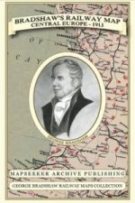
Bradshaw's Railway Map Central Europe 1913
George Bradshaw, Mapseeker Publishing Ltd. | Historical Images Ltd, 2013
50 % šance - Prohledáme celý světJazyk: Angličtina
Vazba: Mapa
561 Kč
-
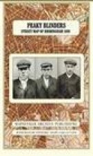
Peaky Blinders Street Map of Birmingham 1892
Historical Images Ltd, 2018
Skladem u dodavatele - Odesíláme za 3-5 dnůJazyk: Angličtina
Vazba: Brožovaná
743 Kč
-

Samuel Bradford Town Plan Birmingham 1750
Samuel Bradford, Mapseeker Publishing Ltd. | Historical Images Ltd, 2013
Skladem u dodavatele - Odesíláme za 3-5 dnůJazyk: Angličtina
Vazba: Mapa
743 Kč
-
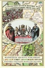
Collection of Four Historic Maps of Cambridgeshire from 1611-1836
Mapseeker Publishing Ltd. | Historical Images Ltd, 2013
Skladem u dodavatele - Odesíláme za 3-5 dnůJazyk: Angličtina
Vazba: Mapa
743 Kč
-
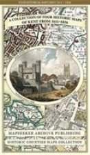
Collection of Four Historic Maps of Kent from 1611-1836
Mapseeker Publishing Ltd. | Historical Images Ltd, 2014
Skladem u dodavatele - Odesíláme za 3-5 dnůJazyk: Angličtina
Vazba: Mapa
743 Kč
-
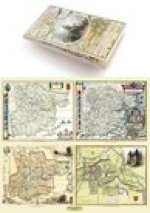
Essex 1610 - 1836 - Fold Up Map that features a collection of Four Historic Maps, John Speed's County Map 1610, Johan Blaeu's County Map of 1648, Thom
Mapseeker Publishing Ltd. | Historical Images Ltd, 2014
50 % šance - Prohledáme celý světJazyk: Angličtina
Vazba: Mapa
743 Kč
-

Worcestershire 1610 - 1836 - Fold Up Map that features a collection of Four Historic Maps, John Speed's County Map 1610, Johan Blaeu's County Map of 1
Historical Images Ltd, 2018
Skladem u dodavatele - Odesíláme za 3-5 dnůJazyk: Angličtina
Vazba: Brožovaná
743 Kč
-
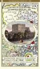
Collection of Four Historic Maps of Norfolk from 1611 - 1836
Mapseeker Archive Publishing Ltd Mapseeker Archive Publishing Ltd | Historical Images Ltd, 2019
50 % šance - Prohledáme celý světJazyk: Angličtina
Vazba: Brožovaná
818 Kč
-

Streetly Village 1918 - Old Map Supplied Rolled in a Clear Two Part Screw Presentation Tube - Print size 45cm x 32cm
Mapseeker Archive Publishing | Historical Images Ltd, 2011
50 % šance - Prohledáme celý světJazyk: Angličtina
Vazba: Mapa
488 Kč
-
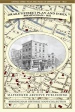
James Drake's Street Plan and Index of Birmingham 1832
James Drake, Mapseeker Publishing Ltd. | Historical Images Ltd, 2013
50 % šance - Prohledáme celý světJazyk: Angličtina
Vazba: Mapa
743 Kč
-
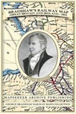
Bradshaw's Railway Map Great Britain and Ireland 1852
George Bradshaw, Mapseeker Publishing Ltd. | Historical Images Ltd, 2013
Skladem u dodavatele - Odesíláme za 3-5 dnůJazyk: Angličtina
Vazba: Mapa
743 Kč
-
Collection of Four Historic Maps of Liverpool from 1785-1903
Mapseeker Publishing Ltd. | Historical Images Ltd, 2014
Skladem u dodavatele - Odesíláme za 3-5 dnůJazyk: Angličtina
Vazba: Mapa
743 Kč
-
Cornwall 1611 - 1836 - Fold Up Map that features a collection of Four Historic Maps, John Speed's County Map 1611, Johan Blaeu's County Map of 1648, T
Mapseeker Publishing Ltd. | Historical Images Ltd, 2014
50 % šance - Prohledáme celý světJazyk: Angličtina
Vazba: Mapa
743 Kč
-
County of Sussex 1611 - 1836 - Fold Up Map that features a collection of Four Historic Maps, John Speed's County Map 1611, Johan Blaeu's County Map of
Mapseeker Publishing Ltd Mapseeker Publishing Ltd | Historical Images Ltd, 2019
Skladem u dodavatele - Odesíláme za 3-5 dnůJazyk: Angličtina
Vazba: Brožovaná
743 Kč
-
Derbyshire 1610 - 1836 - Fold Up Map that features a collection of Four Historic Maps, John Speed's County Map 1611, Johan Blaeu's County Map of 1648,
Mapseeker Publishing Ltd. | Historical Images Ltd, 2014
Skladem u dodavatele - Odesíláme za 3-5 dnůJazyk: Angličtina
Vazba: Mapa
743 Kč
-
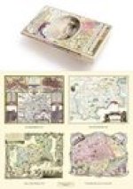
Middlesex 1611 - 1836 - Fold Up Map that features a collection of Four Historic Maps, John Speed's County Map 1611, Johan Blaeu's County Map of 1648,
Mapseeker Publishing Ltd. | Historical Images Ltd, 2019
Skladem u dodavatele - Odesíláme za 3-5 dnůJazyk: Angličtina
Vazba: Brožovaná
743 Kč
-
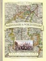
Revolutionary Times Atlas of Warwickshire and Worcestershire - 1830-1840
Paul Leslie Line | Historical Images Ltd, 2018
50 % šance - Prohledáme celý světJazyk: Angličtina
Vazba: Pevná
743 Kč
-
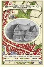
Thomas Hanson Town Plan of Birmingham 1778
Thomas Hanson, Mapseeker Publishing Ltd. | Historical Images Ltd, 2013
50 % šance - Prohledáme celý světJazyk: Angličtina
Vazba: Mapa
743 Kč
-

Aston Manor 1796 - Old map Supplied in a Clear Two Part Screw Presentation Tube - Print Size 45cm x 32cm
Mapseeker Archive Publishing Ltd | Historical Images Ltd, 2023
50 % šance - Prohledáme celý světJazyk: Angličtina
Vazba: Brožovaná
488 Kč
-
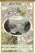
Collection of Four Historic Maps of Bristol from 1851-1903
Mapseeker Publishing Ltd. | Historical Images Ltd, 2013
Skladem u dodavatele - Odesíláme za 3-5 dnůJazyk: Angličtina
Vazba: Mapa
743 Kč

Nejpopulárnější internetové knihkupectví. Zjistěte více
Filtrovat výsledky
Osobní odběr Praha, Brno a 12903 dalších
Copyright ©2008-24 nejlevnejsi-knihy.cz Všechna práva vyhrazenaSoukromíCookies
 Vrácení do měsíce
 571 999 099 (8-15.30h)